
Wenatchee Neighbor Record Layers
The immediate Wenatchee block appears in several public systems, and each answers a different question. Parcel maps show which lots touch. The assessor supplies tax-roll details. Permits reveal public work tied to an address. Recorded documents explain title and easements. Voter fields have statutory limits. City neighborhood services help residents organize without publishing a list of everyone in each household.
| Source | What It Shows About a Block | Access |
|---|---|---|
| Chelan PACS | Tax owner, situs and mailing addresses, parcel, value, sales clues | Public address search; owner caveat |
| Chelan and City GIS | Touching lots, acreage, boundaries, zoning, UGA, easements | Public map selection; accuracy disclaimer |
| SmartGov | Permits, projects, inspections and notices by parcel | Public portal; request deeper files |
| Auditor Acclaim | Deeds, liens, plats and easements tied to names or legal descriptions | Online modes; older microfilm |
| Washington VRDB | Disclosable voter fields | State request with legal restrictions |
| City neighborhood program | Owner-list help, Block Watch, projects and block-party support | City assistance, not a household directory |
| WAGS and maps | Past occupants and historic block context | Local collections and public scans |
An owner name can point to a recorded interest. It cannot establish every current occupant. Preserve that line from the first click onward.
Map Wenatchee Neighbors Outward
Open the Chelan County mapping entry, accept its disclaimer, and locate the known parcel. The popup can supply parcel ID, parcel number, owner, address, and an assessor link. Then read every nearby polygon on its own. Do not assume that two lots with the same owner share one household.
- Locate the starting address, owner, Property ID, or parcel number.
- Record the target parcel boundary, situs, parcel number, and source date.
- Click every touching or nearby polygon and save parcel IDs before copying names.
- Follow each assessor link and compare the physical situs with the tax mailing address.
- Check street access, alleys, easements, rail or river edges before calling two parcels neighbors.
The ArcGIS service supports spatial and distance queries, but the reviewed public text did not confirm a button labeled “buffer.” Use visible parcel selection instead of claiming a feature that may not appear in the current interface. For every address along a full named road, use the Wenatchee street directory workflow.
Inspect Wenatchee Parcel Fields
The official Wenatchee parcel map service exposes the local layer behind address, owner, acreage, assessor, and permit links.
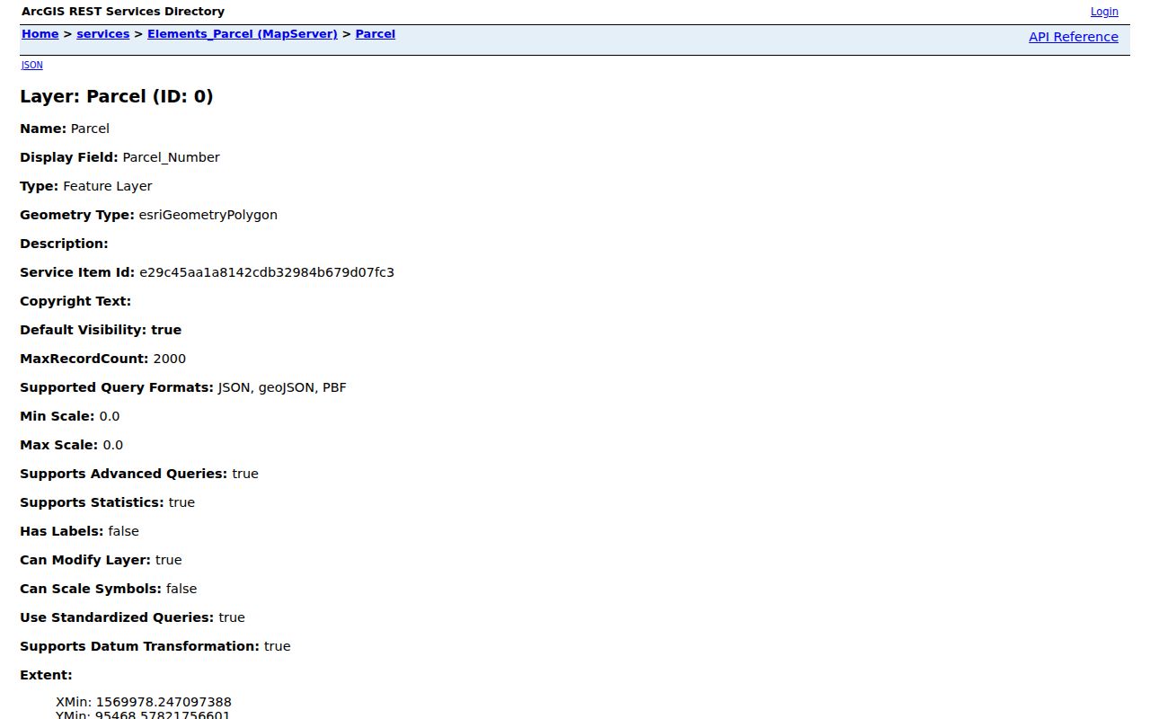
This source is useful for discovering the lots around one point. Its map geometry and popup data still need confirmation in the assessor roll and recorded instruments.
- Parcel
- A separately described tract of land with a county identifier.
- Situs address
- The physical address assigned to a parcel.
- UGA
- The urban growth area, which can extend beyond current city limits.
- Easement
- A recorded right to use part of land for access, utilities, or another stated purpose.
Separate Wenatchee Owners From Occupants
The Chelan Assessor Property Search lets a user search by street number, street name, city, owner, Property ID, or Geographic ID. Its card can show owner text, mailing address, situs, values, exemptions, sales clues, and a legal description. The county warns that an owner field may identify a taxpayer rather than the legal owner.
A matching mailing and situs address can be a useful clue, but it still does not prove who currently lives there. Exemptions also should not be turned into claims about a person's presence or private condition. Verify title through a deed when ownership matters. Do not infer renters, children, relatives, or other household members from a parcel card.
Key distinction. Wenatchee's city program offers help with property-owner lists, not a list of every resident on a block.
Layer the Wenatchee Block
The Wenatchee Boundaries map service adds City Limits Present, zoning districts, the 2017 UGA, storm-water and sewer maintenance zones, and several kinds of easement. Those layers explain why two adjacent parcels may have different permit offices, land-use rules, or services. They are more useful for shared civic context than a bare list of names.
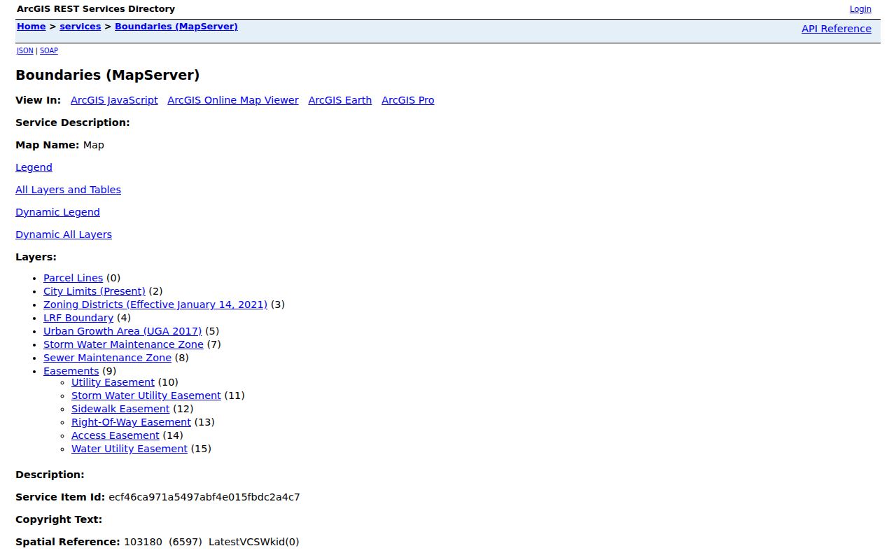
The service inventory makes jurisdiction visible. Confirm the live layer date before relying on it, especially where annexations from roughly 1985 through 2021 changed the line between city and county responsibility.
Rear lots, alleys, steep foothill parcels, rail corridors, and rights-of-way can also make a map neighbor different from a front-door neighbor. Record both physical adjacency and street access.
Read Wenatchee Voter Fields Carefully
Washington law makes some voter-registration fields public, including name, address, political jurisdiction, gender, year of birth, voting history, registration date, and registration number. Full birth dates, registration source, identification numbers, and protected-voter data are withheld. A registered address reflects election eligibility and precinct placement. It does not prove daily physical presence.
VoteWA is an individual sign-in using first name, last name, and date of birth. It is not a public map of Wenatchee neighbors. A lawful block-level file request goes through the Secretary of State VRDB extract process, which asks for requester contact details and a file choice. RCW 29A.08.740 limits use and creates penalties for prohibited conduct.
Note: Before the statewide database launched in 2006, Washington's counties maintained separate voter lists, so older research needs archival context.
Connect With Wenatchee Neighbors
Wenatchee has promoted neighborhood planning since 1998. The City Neighborhood Programs route supports safety audits, fire and crime prevention, code or structural inspections, improvement plans, projects, training, grants, and partner coordination. Improvement work can address lighting, sidewalks, safe walking routes, traffic calming, landscaping, trees, and neighborhood identity.
Neighborhood Programs
Ask about property-owner list help, planning, neighborhood projects, and partner support through the City of Wenatchee.
Block Watch
City-supported training offers a civic and safety route for people who already live on the block. Private rosters are not public records.
Block Parties
Street-closure and permit support can help organize a public block event without exposing household membership.
Community Partners
Named partners include the Chamber, Downtown Association, health district, PUD, arts groups, schools, and service clubs.
The city page does not publish a complete list of named neighborhood associations or HOA members. Do not invent one. The Wenatchee Valley Chamber's public business directory adds business context, not residential identity.
Check Wenatchee Shared Projects
The Wenatchee SmartGov permit portal can show permits, projects, inspection history, public notices, and reports tied to an address or parcel. Use it to understand construction, access work, or land-use activity that affects the block. An applicant or owner named in a permit is not a roster of people who live nearby.
When the public portal lacks a known file, make a focused City records request using the address, approximate date, and record type. Code-enforcement material may also be available through hearings or a request. Ask for a defined record instead of requesting private household data.
Compare Wenatchee Neighbor Sources
Official sources and commercial neighbor tools serve different roles. County and city records identify a custodian, a defined field, and a route to confirm the result. Commercial compilations may merge old addresses and inferred relationships without showing when each fact changed.
| Question | Official Record | Commercial Compilation |
|---|---|---|
| Who owns a parcel? | Assessor lead, then Auditor deed | May repeat stale tax data |
| Which lots touch? | County or City GIS | Map source may be unclear |
| Who occupies a home? | No complete official roster | Often inferred and unverified |
| How can it be corrected? | Contact the named custodian | Process and source vary |
Use the official roll for a narrow public fact. If it does not answer the question, that gap is not permission to publish a guess.
Place Wenatchee Blocks in Time
The Grandview Historic District covers six full and two partial blocks with 141 properties. It draws from the 1892 Amended Great Northern Plat, the 1903 Grand View Addition, and the 1920s Jackson Place Addition. Those layers help explain differing lot forms and development dates around Delaware, Washington, Miller, Idaho, Alaska, and parts of nearby streets.
For an older block, the December 1899 Sanborn sheets can show buildings and uses. WAGS directories can add past occupants. The cemetery map can add burial context. None identifies today's Wenatchee neighbors, but each can explain how the block formed and why its parcel pattern looks unusual.
Protect Wenatchee Neighbor Privacy
Public parcel records do not reveal a complete household. Utility customers, delivery data, full dates of birth, identification numbers, sealed court files, protected vital records, and actual addresses covered by Washington's Address Confidentiality Program are not general neighbor-search material. The ACP provides a substitute address and mail forwarding for qualifying survivors and certain protected workers or officials.
Keep results at the level the source supports: parcel owner, tax mailing address, situs, recorded party, permit applicant, or public voter field. Never expand a narrow fact into a private claim about family members or routines.
Lawful use. Neighbor lookup is for civic connection, block history, and personal safety awareness. Never watch, threaten, intimidate, or harass another person.